WDFW Beach Season Information
Clam, mussel, and oyster seasons OPEN for harvest year-round.
This is a boat access only beach and it is not part of Oak Bay County Park.
WDFW shellfish seasons indicate the specific times of year when harvesting is permitted. Before heading to the beach, please also check the Department of Health (DOH) information below which is related to health of the shellfish and may be updated daily. To harvest on this beach, it must be both during the WDFW approved season and approved by the DOH.
![]() West Oak Bay
is accessible by boat only. There is no upland access to this beach.
West Oak Bay
is accessible by boat only. There is no upland access to this beach.
WDFW surveys conducted in the 1980s and early 1990s found good numbers of native littleneck clams and butter clams at Oak Bay. There are also lesser numbers of Manila clams and cockles available on this beach. Oysters are not common at this location.
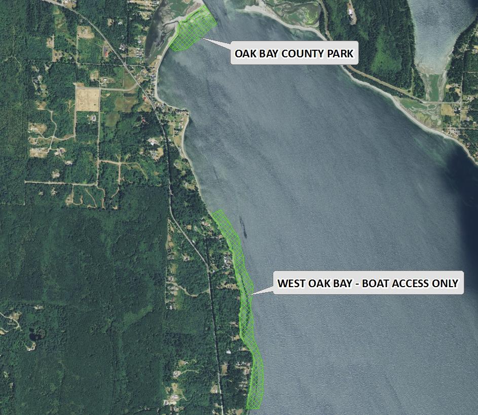
Oak Bay is boat access only. There is no upland access to this beach and there is no land access from Oak Bay County Park. This beach is just under one mile long from boundary to boundary. A distinguishing feature of Oak Bay is that the 48th parallel runs through the beach. The 48th parallel is about 0.3 miles north of the southern boundary of Oak Bay and about 0.6 miles south of the northern boundary (see photo of beach). Harvesters are advised to stay near the 48th parallel to avoid trespassing.
Nearest boat ramps: The Mats Mats Bay boat ramp (located at the southern end of Mats Mats Bay) is about 3.8 miles by boat from where the 48th parallel crosses Oak Bay .
None. There is a pit toilet at the Mats Mats boat ramp. There are facilities for boaters at the Port Ludlow Marina.