WDFW Beach Season Information
Clam, mussel, and oyster season CLOSED to harvest in 2024 due to a decline in shellfish abundance.
Declining clam populations at Oak Bay County Park have require a conservation closure since 2022.
WDFW shellfish seasons indicate the specific times of year when harvesting is permitted. Before heading to the beach, please also check the Department of Health (DOH) information below which is related to health of the shellfish and may be updated daily. To harvest on this beach, it must be both during the WDFW approved season and approved by the DOH.
The clam digging area at Oak Bay is east of the small boat ramp at the end of the access road. Native littleneck clams and Manila clams can be found in the mid-high tidal zone from the boat ramp to the jetty. Butter clams, horse clams and cockles are also found in this area in the mid-low tidal zone.
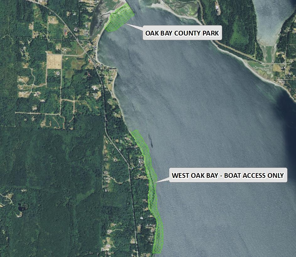
To reach Oak Bay County Park from the west on Highway 104 take the Chimacum/Port Townsend/Quilcene exit (a left hand turn) and travel north on Center Road for about 10 miles to Chimacum. Go straight through the four-way stop and continue about two miles to Port Hadlock. Turn right onto Oak Bay Road and proceed for about one and a half miles. Look for the sign on the left for the access roads to Oak Bay County Parks (Cleveland Street/Portage Way). Take a left onto Cleveland Street/Portage Way and immediately stay right at the Y onto Portage Way until you come to the beach. If you don't take the right onto Portage Way, Cleveland Street will lead you to an upland section of Oak Bay County Park that is not accessible from the beach area. There is parking along the road as well as at the end of the road.
To reach the site from the east on Highway 104 from the Hood Canal Bridge take the Port Townsend/Port Ludlow exit (a right hand turn) and travel north on Beaver Valley Road (Highway 19) for about seven miles to Chimacum. Take a right at the four-way stop and continue about two miles to Port Hadlock. Turn right onto Oak Bay Road and proceed for one and a half miles. Look for the sign on the left for the access roads to Oak Bay County Parks (Cleveland Street/Portage Way). Take a left onto Cleveland Street/Portage Way and immediately stay right at the Y onto Portage Way until you come to the beach. If you don't take the right onto Portage Way, Cleveland Street will lead you to an upland section of Oak Bay County Park that is not accessible from the beach area. There is parking along the road as well as at the end of the road.
Please note that vehicle access and parking may be seasonally limited to the south end of Portage Way near the restroom and kiosk.
There are vault toilets, a car-top/kayak boat ramp, and R.V. camping at Oak Bay County Park. The upland section of the park also has campsites, a playground and restrooms.