WDFW Beach Season Information
Clam, mussel, and oyster seasons CLOSED for harvest year-round.
Washington Department of Health (DOH) cautions that clams, oysters, and mussels from this beach are not fit for human consumption at any time.
WDFW shellfish seasons indicate the specific times of year when harvesting is permitted. Before heading to the beach, please also check the Department of Health (DOH) information below which is related to health of the shellfish and may be updated daily. To harvest on this beach, it must be both during the WDFW approved season and approved by the DOH.
Beach map
Image
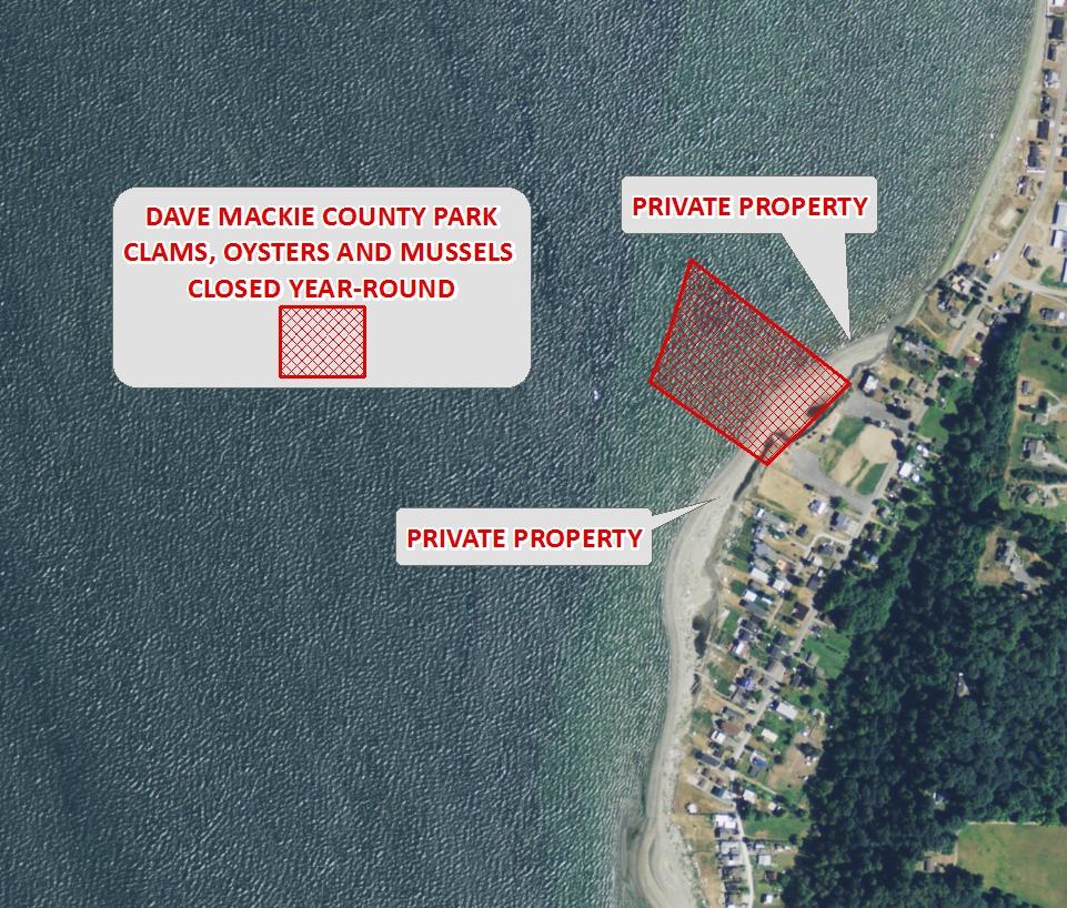
Disclaimer: Map areas
identify approximate public property boundaries and should not be
considered legal property boundaries. Many of these public beaches
have no upland entrance and must be accessed by boat. Please respect
adjacent private property. This map is provided for informational
purposes only. The accuracy of this map is not guaranteed.