WDFW Beach Season Information
Clam, mussel, and oyster seasons OPEN for harvest year-round.
WDFW shellfish seasons indicate the specific times of year when harvesting is permitted. Before heading to the beach, please also check the Department of Health (DOH) information below which is related to health of the shellfish and may be updated daily. To harvest on this beach, it must be both during the WDFW approved season and approved by the DOH.
![]() DNR-59 (Hood Canal)
is accessible by boat only. There is no upland access to this beach.
DNR-59 (Hood Canal)
is accessible by boat only. There is no upland access to this beach.
Most of the substrate on this beach is sand. There are horse clams, cockles and possibly geoducks present on this beach. Oysters are not common at this location.
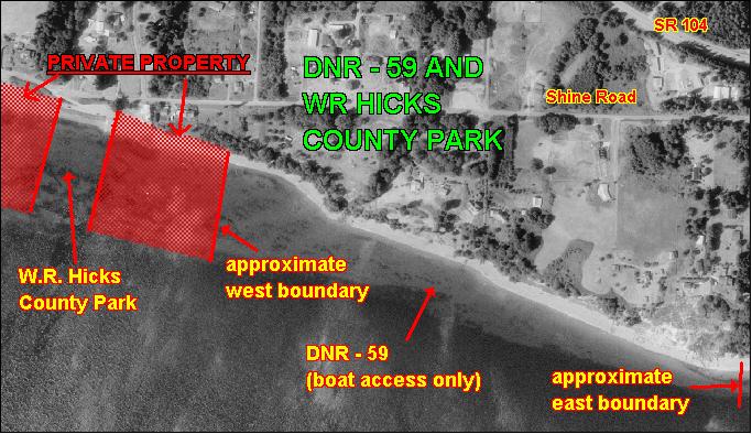
DNR-59 is boat access only. There is no upland access. DNR-59 is about 200 yards east of W.R. Hicks County Park , but the property between the two sites is private. Please do not trespass (see beach map). Approximate GPS coordinates to the the middle of DNR-59 are: 47.865o N, 122.655o W.
Nearest boat ramps: W.R. Hicks County Park (located on Shine Road), the ramp at the west end of the Hood Canal Bridge, and Salsbury County Park (located on Wheeler Street, west of Port Gamble). Salsbury County Park ramp is the better of the three ramps and has a dock. The ramp at the Hood Canal Bridge is useable at nearly all tides, but has limited parking.
None. There is a vault toilet at W.R. Hicks County Park 400 yards to the west. There are also restroom facilities at Salsbury County Park.