WDFW Beach Season Information
Clam, mussel, and oyster seasons OPEN for harvest year-round.
WDFW shellfish seasons indicate the specific times of year when harvesting is permitted. Before heading to the beach, please also check the Department of Health (DOH) information below which is related to health of the shellfish and may be updated daily. To harvest on this beach, it must be both during the WDFW approved season and approved by the DOH.
South Tekiu is a good clam beach. Native littleneck clams are the most abundant species, but Manila clams and butter clams are also available.
This is a good oyster beach.
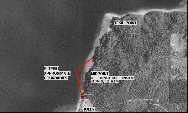
South Tekiu is boat access only. There is no upland access to this beach. South Tekiu is about 0.4 miles long. The north end of the beach is about 0.4 miles south of Tekiu Point. The south boundary of this beach is just north of the community of Holly. Both boundaries may not be marked and there are no outstanding landmarks. Approximate GPS coordinates to the midpoint of South Tekiu are: 47.576º N, 122.969º W. It is recommended harvesters use these coordinates as the best landmark for this beach and stay near this area to avoid trespassing. See beach map for approximate boundaries.
Nearest boat ramps: Triton Cove State Park ramp (located about six miles south of Brinnon on Highway 101) is just over 2 miles by boat from South Tekiu.
None. There is a vault toilet at Triton Cove State Park and facilities for boaters at Pleasant Harbor Marina.