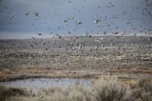
Got a waterfowl hunt planned? Want some help finding where to go for optimum results? We can help. WDFW has developed georeferenced maps of popular waterfowling locations in the Desert Unit of the Columbia Basin Wildlife Area between Moses Lake and George. These maps include regulated access areas that have had recent improvements that should make the waterfowling experience even better. The following maps can be downloaded and are compatible with any georeferenced map mobile application:
Columbia Basin Wildlife Area Regulated Access Areas (PDF)
Frenchman Regulated Access Area (PDF)
North Potholes Regulated Access Area (PDF)
Winchester Regulated Access Area (PDF)
You can view additional WDFW maps and data on many geographic and topic areas. You can also create your own georeferenced PDF maps using Hunt Planner in order to focus on your own areas of interest. To do this, click the print icon and follow the instructions to export a PDF map.
You may also want to look into potentially hunting private lands for waterfowl and tips for successful hunting of the RAAs listed above.
WDFW does not guarantee the accuracy, reliability or completeness of these maps. This information may not meet National Map Accuracy Standards. These products may be updated without notification. The information displayed on these maps should be used for graphic display only.