WDFW Beach Season Information
Clam, mussel, and oyster seasons OPEN for harvest year-round.
![]() DNR 59-A Case Shoal
is accessible by boat only. There is no upland access to this beach.
DNR 59-A Case Shoal
is accessible by boat only. There is no upland access to this beach.
WDFW shellfish seasons indicate the specific times of year when harvesting is permitted. Before heading to the beach, please also check the Department of Health (DOH) information below which is related to health of the shellfish and may be updated daily. To harvest on this beach, it must be both during the WDFW approved season and approved by the DOH.
Case Shoal is a good place to dig for butter clams in cobble substrate. Some large native littleneck clams can be found here as well. Horse clams can be found in the sandy substrate portions of Case Shoal, but these areas are only exposed at extreme low tides (minus two feet or lower).
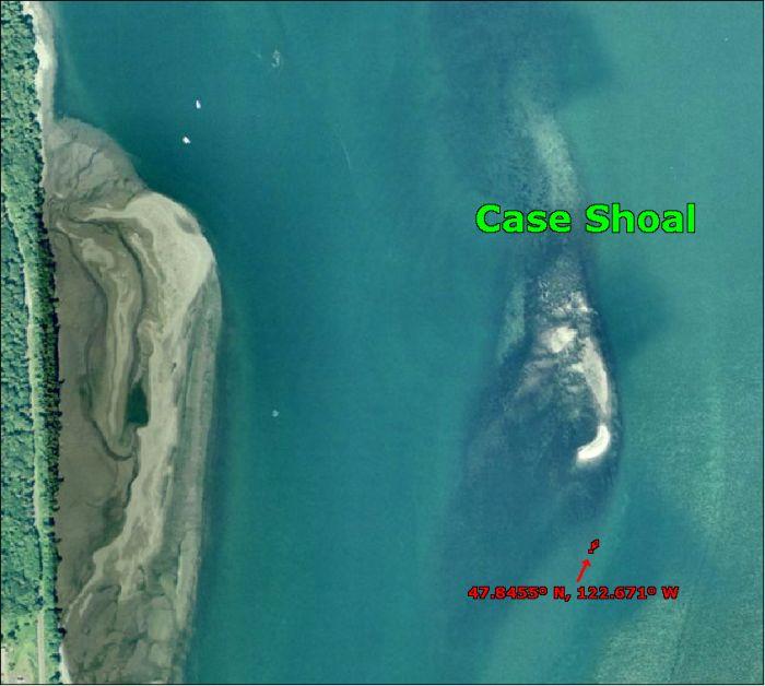
Case Shoal is surrounded by water and accessible by boat only. The only landmark other than the shoal itself is the navigation day marker on the south end of the shoal (see beach map). The closest boat ramps are: W.R. Hicks County Park ramp, located on Shine Road, the ramp at the west end of the Hood Canal Bridge, and Salsbury County Park ramp, located on Wheeler Street west of Port Gamble. Salsbury County Park ramp is the better of the three ramps and has a dock. The ramp at the Hood Canal Bridge is useable during nearly all tidal cycles, but has limited parking.
Approximate GPS coordinates of the navigation marker at the south end of Case Shoal are: 47.8455o N, 122.671o W.
None. The closest facilities to Case Shoal are at Salsbury County Park.