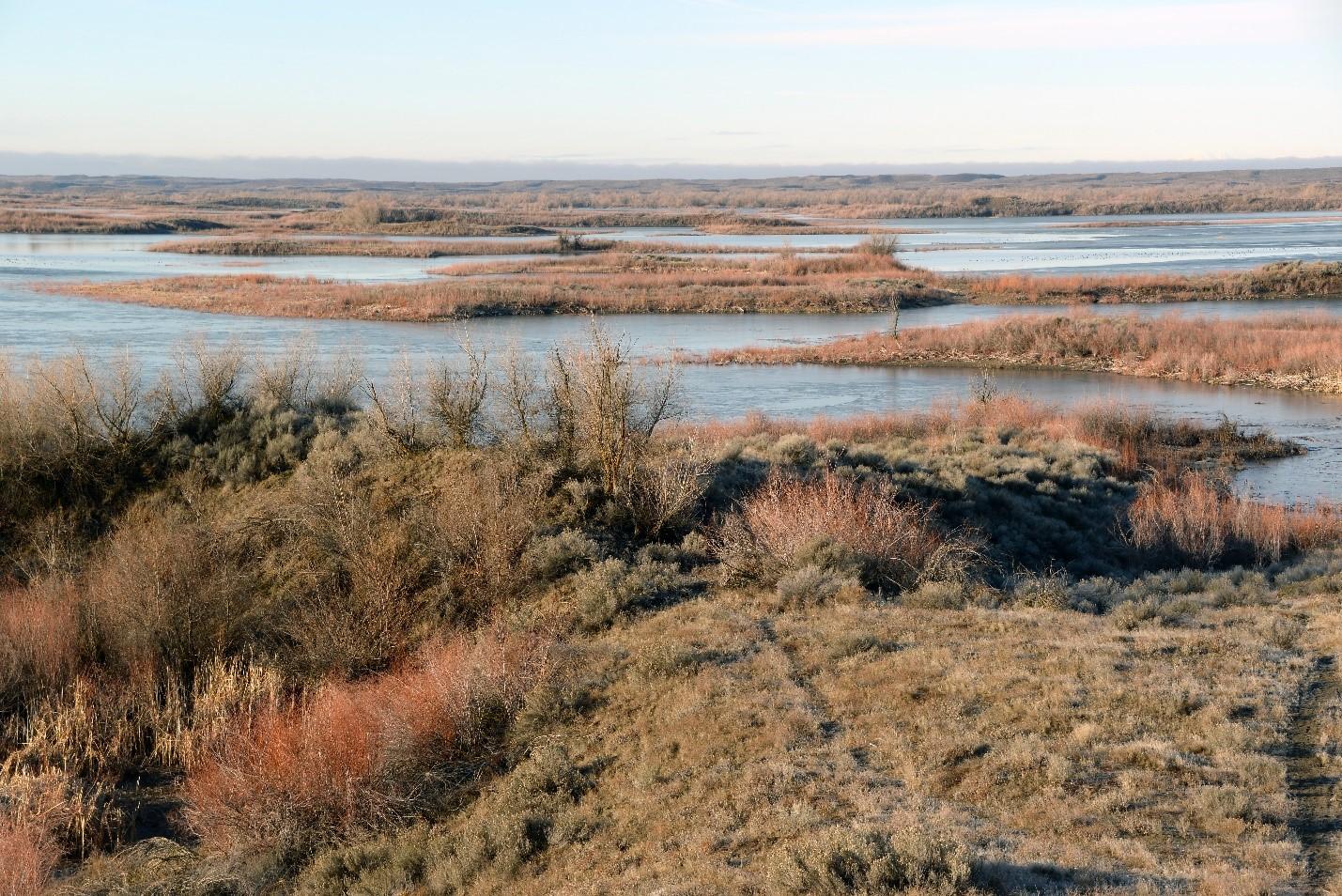
The Potholes Reservoir was formed by O'Sullivan Dam as part of the Columbia Basin Irrigation Project. Reservoir water levels are subject to wide fluctuations because the project's purpose is to gather wastewater and return flows from irrigated lands upstream and store water for reuse on farmland downstream. The Potholes Reservoir Unit provides quality wildlife habitat for many species and offers many public recreation opportunities.
The Potholes Reservoir Unit is located south of Moses Lake in Grant County. It is a large unit that can be accessed from State Route 17, Sand Dunes Road, Highway 262, County Road M SE, and County Road A SE.
The Potholes Reservoir Unit occurs in the Lower Crab Creek Watershed within the Columbia Plateau.
Getting there
Maps and directions to WDFW-managed access points for this unit. Opens Google Maps in a new tab.
Recreation and public access
A Discover Pass is required on WDFW lands -- including water access areas, wildlife areas, and campgrounds -- unless you already have a Vehicle Access Pass issued with the purchase of an eligible hunting or fishing license. Recreate responsibly on public lands: please know the Public Conduct Rules.
Public facility information:
- Several parking areas
- Outhouses
- Boat ramps
Hunting
The Potholes Reservoir Unit is popular for waterfowl and upland bird hunting.
Hunting advisories
- A Game Reserve is established on this unit (WAC 220-411-060). Game Reserves are CLOSED AREAS where hunting and trapping for all wild animals and wild birds is prohibited (RCW 77.12.047).
Fishing
Several parking areas, boat ramps, and outhouses are available on this unit.
Wildlife viewing
This unit includes a reservoir, sand dunes, shrubsteppe, basalt outcroppings with big sage and bluebunch wheatgrass, and some wetlands, offering opportunities to view a variety of wildlife, including mule deer, wintering bald eagle, waterfowl, and northern leopard frog.
Search for potential birding opportunities on or near a wildlife area unit by using eBird Northwest, a citizen science database portal that provides freely-shared bird lists at 'hotspots' and interactive maps plus other birding information updated daily.
Conservation
When O'Sullivan Dam Reservoir was initially filled, it inundated the Crab Creek Channel and about 800 small ponds scattered among the sand dunes of the area. With several thousand acres of water covering the sand dune area, perhaps 1,000 islands were formed in the north and west parts of the reservoir. These seasonally flooded areas currently support a small forest of willow trees. The higher elevation wetlands on the northern and western fringes of the reservoir have cattail and bulrush communities. The western part of the unit still has many active sand dunes. The vegetation there is shrubsteppe except for the wetland areas along the Winchester and Frenchman Hills wasteways. The eastern part of the unit is mostly sand, gravel, and round rock soil, with shrubsteppe vegetation bordered by irrigated farmland. The vegetation of this area is primarily rabbitbrush and needle and thread grass. The southern area, adjacent to O'Sullivan Dam, is mostly basalt outcroppings with big sage and bluebunch wheatgrass occurring where soil exists. The original Crab Creek Channel is exposed again just below O'Sullivan Dam and west of Potholes Canal, the outlet of the reservoir.
Special habitats and species
The northern leopard frog, listed as state endangered, is present in wetland habitat on this unit.
Conservation goals
- Maintain enhanced wildlife habitats and preserve native plant communities and important habitats
- Restore and preserve shallow water habitat and pools
- Manage migrant waterfowl, upland game birds and priority species
The northern leopard frog, listed as state endangered, is present in wetland habitat on this unit.
- Maintain enhanced wildlife habitats and preserve native plant communities and important habitats
- Restore and preserve shallow water habitat and pools
- Manage migrant waterfowl, upland game birds and priority species
Land stewardship
The Potholes Reservoir Unit is U.S. Bureau of Reclamation property that was transferred to State Parks and WDFW for management of fish, wildlife, and recreational purposes. The two agencies agreed that State Parks would administer parks and commercial concessions and the former Department of Game would take charge of fish, wildlife, and grazing on these lands. Under the agreement, the agencies consult with each other and coordinate their management plans to make them as compatible as possible.
Acquisition history
No specific funders assisted with purchasing these lands.