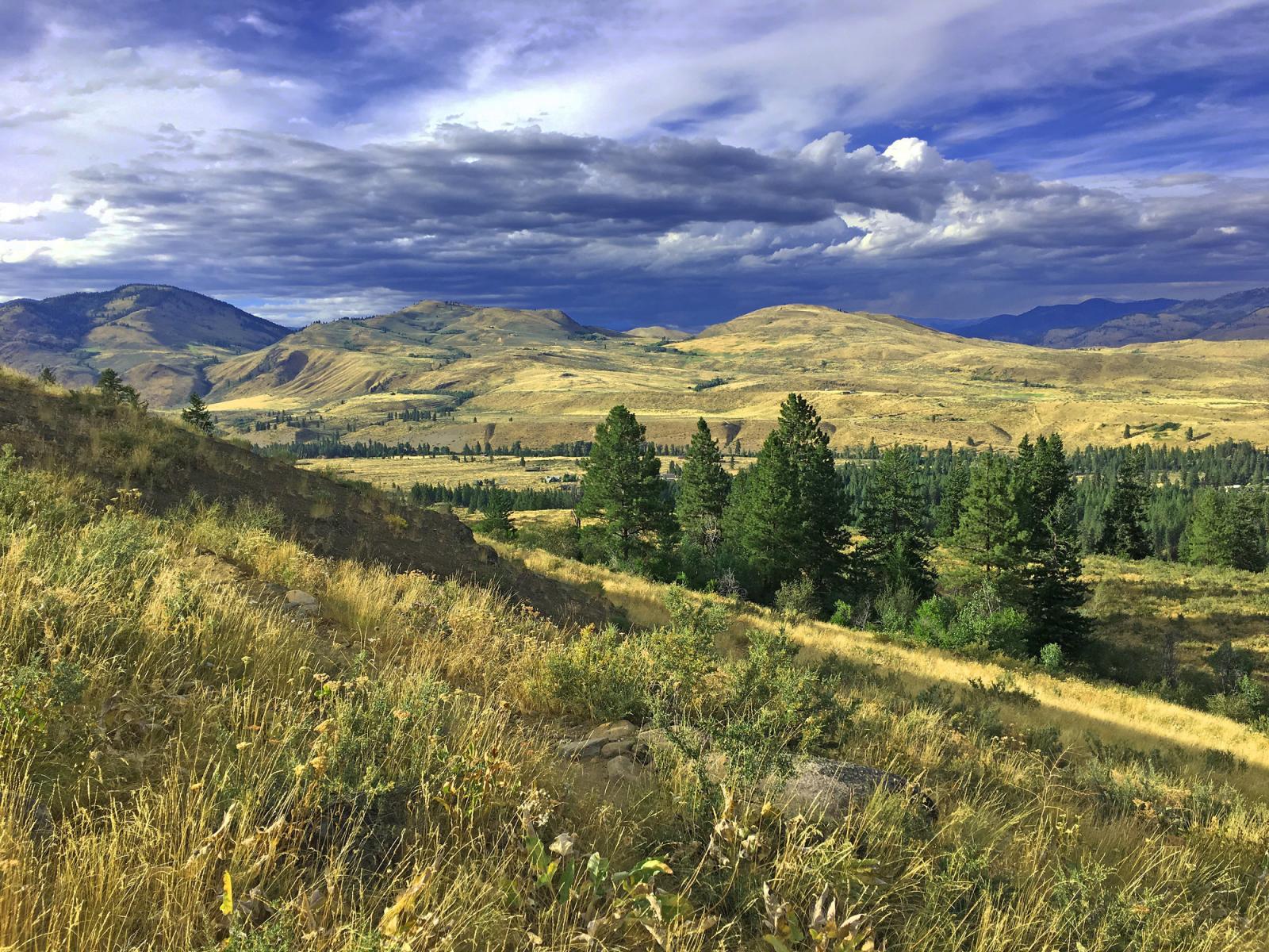
The Rendezvous Unit offers diverse recreation opportunities. Unmaintained trails and old roads lead to Lewis Butte, Riser Lake, and Little Cub Creek areas. Watch for wildflower blooms in mid-May. This unit was purchased for mule deer winter range and migratory corridors, and also serves as a staging area during early spring green up.
The Rendezvous Unit is located north of Winthrop, between the Chewuch and Methow rivers, in Okanogan County. The unit can be accessed from Gunn Ranch Road, off of Rendezvous Road.
The Rendezvous Unit lies within Methow River watershed. The unit is surrounded by private land.
This unit is part of the Methow Wildlife Area.
Game Management Units: 231, 218
Getting there
Maps and directions to WDFW-managed access points for this unit. Opens Google Maps in a new tab.
Recreation and public access
A Discover Pass is required on WDFW lands -- including water access areas, wildlife areas, and campgrounds -- unless you already have a Vehicle Access Pass issued with the purchase of an eligible hunting or fishing license. Recreate responsibly on public lands: please know the Public Conduct Rules.
Public facility information:
- ADA parking area
- ADA restrooms
Recreation and access advisories
- Overnight parking and camping in parking area prohibited.
- Walk in access only. Motorized vehicles are prohibited.
Hunting
Hunting Introduction On this unit, hunters may find opportunities to harvest black bear, cougar, deer, waterfowl, Eurasian collared dove, forest grouse, gray (Hungarian) partridge, moose, mourning dove, quail, small game, and turkey.
Wildlife viewing
This unit includes Riser Lake and creeks with aspen/shrub riparian areas, Ponderosa pine and Douglas-fir forests, sagebrush, bitterbrush, and bunchgrasses, offering opportunities to view a variety of wildlife, including mule deer, cavity-nesting birds, and migratory songbirds.
Search for potential birding opportunities on or near a wildlife area unit by using eBird Northwest, a citizen science database portal that provides freely-shared bird lists at 'hotspots' and interactive maps plus other birding information updated daily.
Other recreational opportunities
This unit offers opportunities to view wildflowers in spring. Unmaintained trails and old, non-motorized roads to Lewis Butte, Riser Lake, and Little Cub Creek areas offer walking/hiking opportunities.
Conservation
South-facing slopes are primarily sagebrush, bitterbrush and bunch grasses. North slopes are timbered with Douglas-fir and Ponderosa pine.
Special habitats and species
Cub Creek, Little Cub Creek, and the Riser Lake have aspen and shrub dominated riparian areas, important for mule deer fawning and nesting habitat for cavity nesters and migratory songbirds.
Conservation goals
- Create, restore, and enhance a mosaic of habitat
- Maintain and restore native plant communities
- Manage mule deer winter range
- Manage for species diversity including game and nongame species
Cub Creek, Little Cub Creek, and the Riser Lake have aspen and shrub dominated riparian areas, important for mule deer fawning and nesting habitat for cavity nesters and migratory songbirds.
- Create, restore, and enhance a mosaic of habitat
- Maintain and restore native plant communities
- Manage mule deer winter range
- Manage for species diversity including game and nongame species
Land stewardship
The Rendezvous Unit was purchased for mule deer winter range and migratory corridors.
Acquisition history
The parcels making up this area were purchased between 1991 and 2022.
| Funder | Fund |
|---|---|
| State of Washington | Transfer of land |
| US Fish and Wildlife Service | Endangered Species Act Section 6 Program |
| US Fish and Wildlife Service | Pittman-Robertson Wildlife Restoration Program |
| WA Recreation and Conservation Office | Washington Wildlife and Recreation Program |
Management planning
2006 Methow Wildlife Area Management Plan
Every eight to 10 years, the Washington Department of Fish and Wildlife (WDFW) revises management plans for each of its 33 wildlife areas to document current conditions, address new agency initiatives, and identify new management priorities and actions. In between those major revisions, WDFW updates plans every two years to outline short-term objectives and accomplishments. In 2014, WDFW began the process of updating existing plans, many of which were written in 2006. The new plans are being developed with significant public participation and input.