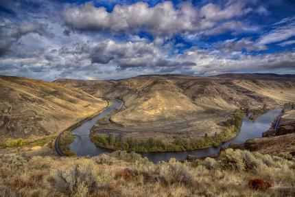
Want a great way to get into the Washington backcountry? Follow the green dots.
Together with the state Department of Natural Resources (DNR) and private landowners, the Washington Department of Fish and Wildlife (WDFW) cooperatively manages many roads within Yakima and Kittitas counties under a "Green Dot" system. This system provides access for camping, hunting, wildlife viewing, and ATV and off-road vehicle riding, while protecting sensitive habitat from damage caused by motorized vehicles.
2022 Green Dot public comment responses from WDFW and DNR (PDF)
How to use Green Dot maps
Using the Green Dot system is easy: roads open to motor vehicle travel are marked with a round green reflector on a white route marker. These roads are shown in green on the area maps. In some areas, public roads (such as county or U.S. Forest Service roads) are used to access the Green Dot system and are shown in gray on the maps.
Any roads not designated as a Green Dot or public access road are off-limits to motor vehicles. Seasonal closures are also shown on the maps; check the map legend for more information.
These roads are used by a wide variety of recreationalists. Please respect others and avoid driving on wet, soft roads in an effort to reduce damage.
Maps are reviewed annually and typically updated after May 1.
Print your own map
Select a map (using the 11-inch-by-17-inch option) from the list below to print your own copy of a map. They must be printed in color to clearly see all the features; printing in black and white may compromise the information or make it difficult to read.
L.T. Murray Wildlife Area
Colockum Wildlife Area
Wenas Wildlife Area
Oak Creek Wildlife Area
Quilomene wildlife unit
Whiskey Dick wildlife unit
Ahtanum State Forest
Naneum Ridge State Forest
Get Green Dot maps on your smartphone
Want to use a Green Dot map on your smartphone? Search for "PDF Maps" in the Google Play Store or Apple App Store, download the “Avenza Maps” app to your phone, then download one of the 38-inch-by-26-inch Green Dot area maps listed on this page. When you open the map in the app, you'll be able to see your location on the map to aid in navigation.
Pick one up
Hard copies of Green Dot maps (in useable black-and-white format) are available at individual wildlife area headquarters, and the following locations:
WDFW Yakima Regional Office
1701 S. 24th Ave
Yakima, WA 98902
509-575-2740
WA DNR Southeast Region Office
713 Bowers Rd
Ellensburg, WA 98926